• M A P S •
Home Buy Services Resources Showcase Contact
First and
foremost is the "Indian
Country Guide", a general usage roadmap published
by the American AutomobileAssociation.
This map
is the absolute best for visiting the Colorado
plateau.
It is a sheer pleasure to look at and use and it
makes finding geological phenomena or landmarks,
such as the Grand Staircase or the Waterpocket
Fold, very easy. A few years back, the map did not
include the Arches/Canyonlands area, a really
painful omission. This has now been fixed by the
good people at the AAA by putting this area on the
back of the map. Unless you intend to do some
heavy-duty hiking or fourwheeling, this map is
quite sufficient for an ordinary car-based trips.
Note that it doen't cover the Southern part of
Arizona and New Mexico.
The
maps are classified by scale, beginning with the largest and
most general level.
Detailed
Road Map Southeastern Utah and
Southwestern Utah maps are published by the Utah
Travel Council. Roads and tracks are indicated in a
very precise fashion. These maps can prove very
useful used in conjunction with the Indian Country
map, especially to find 4WD trails of lesser
importance. National
Parks and Monuments
Miniguides: these wonderfully concise
mini-guides are packed with all the essential
information about the parks, their history, geology
and fauna. You can get them at the entrance to the
parks or at the Visitor Centers. They will help you
find your way around on roads and trails.
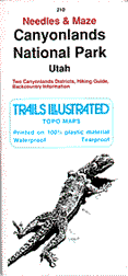
Trails
illustrated Topographic Maps : if you plan
on adventuring along the trails and roads in
distant parts of the National Parks, the
topographic maps of the illustrated Trails series,
printed on waterproof, foldable paper, are
extremely well made and highly recommended. The
author always uses them for hiking in the
parks.
4x4
topographic maps: Fran Barnes' maps in the
Canyon Country series are excellent. They are U.S.
Geological Survey topo maps on which are
superimposed the numerous and little frequented 4x4
trails. They are extremely practical if you travel
with a 4x4.
Find photos of the
Southwest and Colorado Plateau in Photographing
the Southwest
and Land
of the Canyons,
the Photo Trip USA landscape photography guidebooks.
Material, design and coding,
Copyright 1998-2006 by Graphie International, Inc., except as noted.
All Rights Reserved.
If
you only take one map...

Other
nice maps to have when visiting the Colorado
Plateau


PhotoTripUSA™ is a trademark of Graphie International,
Inc.